6 Thursday
Death Valley day. I had
set the palm pilot alarm for 5:15am in order to head off into Death Valley
in the relative cool of the early morning. (It still seemed about 23-25
degrees though). We checked out at 6am and set off east from Ridgecrest
into the Panamint Valley. Passing through Trona at this early hour the
place looked like a ghost town. Trona gets its name from the mineral trona
which is found in large quantity on the dried lake beds. People in Trona
mine trona. Parts of the town seemed to be simply abandoned, it seems
because having finished mining at a particular location they have simple
relocated part of the town to a new mine location. Trona (the mineral)
is used to make soda ash which in turn is used in making glass. On through
the valley with the Argus range on the left and China Lake Weapons Research
beyond that, we connected with highway 190 just past the town of Panamint
which we could see off to the left showing as a small green oasis in a
vast sea of brown and grey.

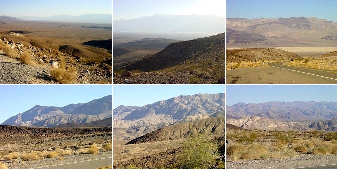
Turned right to wind up through the Panamint range

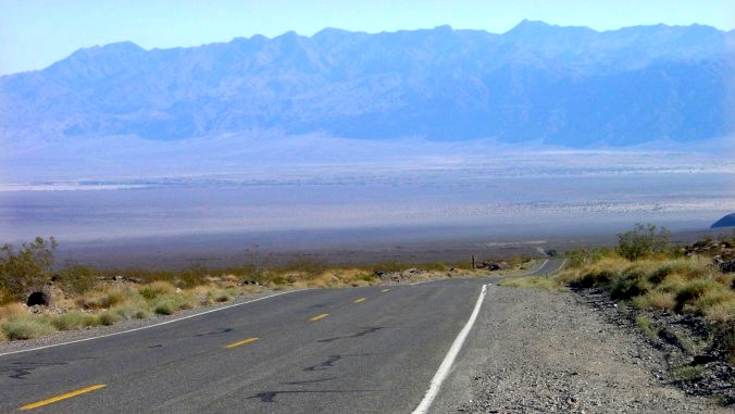
and then a long straight descent down one of the alluvial fans down to the floor of Death Valley

and to the rest point of Stove Pipe Wells at an elevation of 5 feet above sea level.
Stove Pipe Wells could not be described as a town nor even a village, consisting of a general store, a gas station, some cabins and offices to house the park officials together with some green trees. We stopped there for a while for pictures and a look around in the general store. It was unbearable to be standing in the sun for longer than a few minutes even though it was still only about 10:30am. The woman in the gift shop (yes, even here) said the temperature yesterday had reached 115 F (46.1 C) and was expected to reach that again. Saw two huge crows sitting on a railing outside one of the cabins and of course I had to take their picture. They were very tame, probably the local pets. There was a swimming pool as part of the cabins which looked very inviting (where do they get the water?) . From Stove Pipe Wells we continued along the 190, pausing to admire the big deposits of sand dunes to the left and further on turned right at the junction with the road which headed north to Scotty's Castle, but we headed south. After about 45 minutes, Furnace Creek appeared as an oasis in the brown and rocky landscape. We stopped there to explore the museum which was well presented and very interesting. I was going to top up with petrol, but with the price at $2.45 per gallon, and with 3/4 tank left I decided to flag that away. Off on a small side road we got out of the car to walk about 200 yards up a small hill to a lookout point called Zabriskie Point where I took photos of the strange rock formations and of the valley.
Zabriskie Point Looking across the valley
Zabriskie Point. Looking south
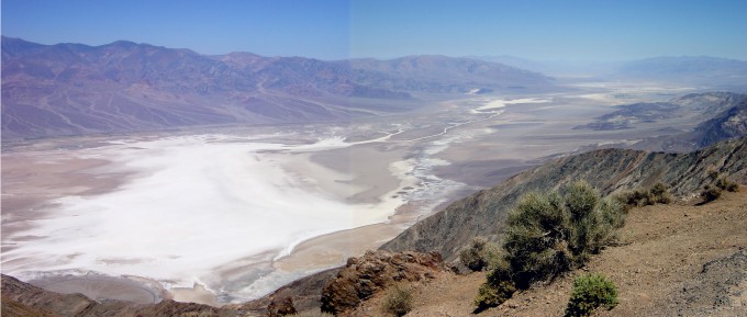
Because of the heat, Sally was exhausted after the walk up to the look out and took a while to recover with the car's AC system going flat out and more water to drink. (Both of us had been drinking a lot of water due to the heat and very low humidity. A 'feature' of the low humidity is that if you don't take the precaution of touching the metal part of the car as you get out you just about risk electrocution with the static electricity charge build up between you and the car. Grounding yourself on the car frame is essential to avoid a nasty wake up jolt). Onwards along the road to Death Valley Junction. Part way along here we took the side road to Dante's View, climbing from about 50 feet below sea level to over 5500 feet where there was a stunning view overlooking the valley from Badwater, the lowest point at 250 feet below sea level, around to Furnace Creek and further north.

Dante's View
Temperature outside was some 20 degrees C cooler than down on the valley floor and we found it quite pleasant, even though it must have still been about 30 degrees C. After many photos and a quick chat to some other tourists, we descended the hill, took the road out of the valley to Death Valley Junction and then the signposted direct route to Las Vegas even though the road didn't appear on our map. The road took us directly to Pahrump (Nevada!) where we got gas and then we took the 160 highway which lead into the south of Las Vegas. Stress levels rose 50 points when we tried to navigate through or around this chaotic city. By a mix of good luck and bad navigating we managed to take road/freeway combinations that skirted us around the south of Las Vegas, through Henderson and on to Boulder City where I had previously thought might be a good place to stay. We found a Super 8 motel (the same chain of the previous 2 nights) and immediately collapsed with a strong cup of coffee, an air conditioned room and a map of Las Vegas to get ourselves orientated.
The wind had got up a bit by this time and walking outside was like being immersed in a hot bath. It felt as if you were being burnt by the dry, hot wind but our skin never actually got burnt except by direct exposure from the sun. All buildings in the hot areas of California especially the desert regions have air conditioning (AC) and we soon realised that you only left the AC environment if you absolutely had to.
Later, in the evening on the TV news, it was reported that Death Valley had reached the highest recorded temperature ever for the month of June. (127 F, 52 C). We felt like pioneers. Braved Death Valley and won!